CHAIN SAW WORK OUTMy yard projects this
year got an early jump start back on February 23, 2016 when we had some
serious high winds akin to a small tornado that came through the night with
wind gusts around 70 mph +- of which there was a wind advisory warning in place until
the following morning.
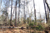
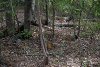
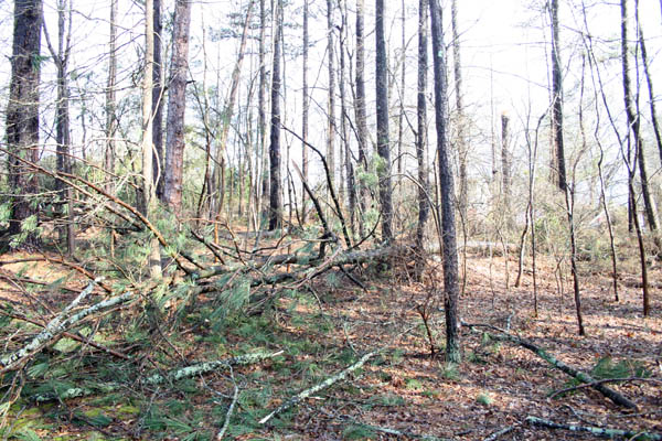
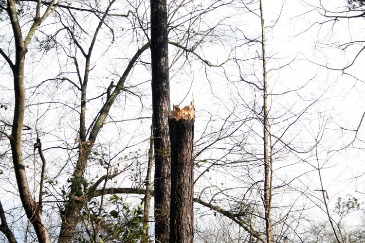
The next morning, I observed a couple large pine trees at least 60 plus
feet in height at the upper end of our property that were sheared/twisted off about
1/3 from the ground indicating we had some tornadic winds; e.g., twisting rotation.
Luckily, the trees fell away from the neighbors home and they were tall
enough to land very close if not on their home if they had fallen in the
other direction but the wind was coming from the South to South West.
Click on below thumbnail pixs of the fallen trees for a larger screen
view:


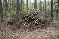
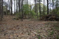
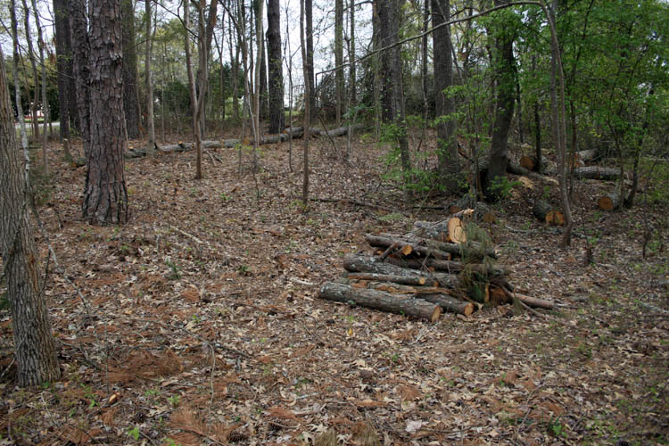
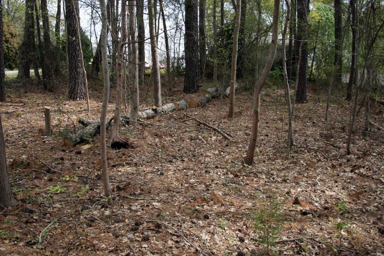
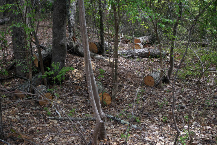
I waited several days before getting the ole farm model 55 Husqvarna chain
saw out to clean up the mess. The main body of the two fallen pine trees
were to large for me to move around even after cutting into smaller lengths and left them where they fell until
later when they dry out.
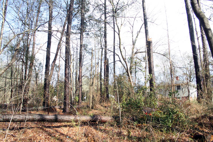
Click on below thumbnail pixs for a larger screen view;

I sharpened the chain on the husky but it was cutting on a bias to the lower right
which means I sharpened one side of the chain more than the other. I
only use the chain saw a few times a year and guess I lost my touch
on the chain sharpening this time.
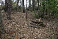
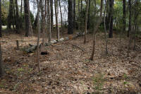
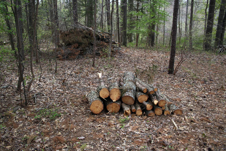
I plan to go back and cut the remaining two standing long stumps off near
ground level when they dry out a little and maybe be able to roll the larger
portions of the trees already cut in a neat pile.
I placed a new chain on the chain saw and had my friend Robert Webster of
Hamlet, NC have The Hamlet Hardware Store machine sharpen two used chains for me.
Regular small engine dealers will sharpen about half the teeth away on a
sharpen job where you will have to purchase a replacement chain much
quicker; not this time! I recently learned from some pros using chain
saws, you need to flip over the chain saw bar often to keep it from wearing
uneven too. I have owned that particular model chain saw and never
rotated the chain saw bar.....my bad and hope it is not the bar worn instead
of a poor sharpening job on the chain. I put a new chain on the saw
and will find out when I use it again.
LAWN TRACTOR/MOWER SERVICED
The lawn tractor and weed trimmer were recently serviced; oil and filter
change and greased the fittings for the start of
our grass mowing season and got 80 pounds of 12-12-12 fertilizer spread
waiting on the rain to come this weekend per the Weather Prophets.
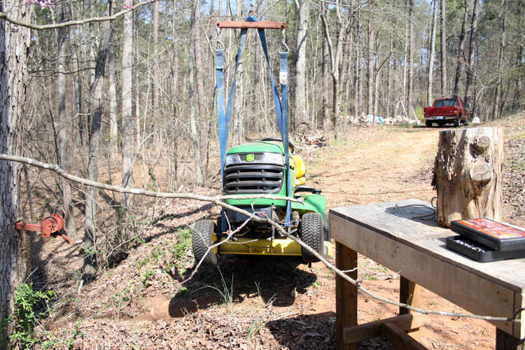
Below pix of the lawn tractor/mower with the front suspended and hanging
from a White Oak tree I named
Tom Dooley that I use to skin and quarter deer
from. No wonder that women out live men,
since crawling under the front end to remove the blades from the mower deck
for sharpening and/or replacing is a serious safety hazard without some type of auxiliary
support means:
After a good soaking rain, I plan to aerate the hard packed red clay soil, broadcast some Bermuda
and/or Centipede grass seeds and continue to remove the ever
present dandelions. The chemicals that I have used in the past to keep
the dandelions in check, do no penetrate far enough to their roots to totally
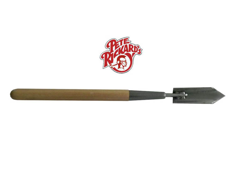
eliminate their root structure. I now remove them the
hard way; with a small
trappers shovel, whereas some of the dandelions have roots
similar to small carrots. Dandelion is generally an apomictic plant
and seed production normally occurs without pollination. Seed
production varies from 54 to 172 seeds per head and a single plant can
produce more than 2000 seeds. There is more dandelion below ground than
above ground but the above ground portion does the most damage with the
propagation of those seeds. No small wonder they keep coming back year after
year with such a high seed production rate!
Web published by Bill aka Mickey Porter on 03-25-16 and updated on
03-26-16.
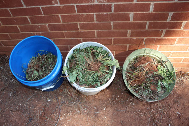
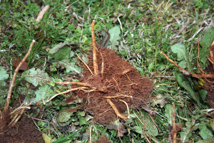
Below pix gives a good size relationship to the root structure of the
dandelion with the 5 gallon bucket as a reference!
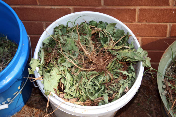
I have already removed at least 10 gallons of dandelion roots in addition
to those shown above and probably have another 15 to 25 gallons more to
remove.
Web published update by Bill aka Mickey Porter on 04-28-16.
RED CLAY SOIL AERATED AND GRASS SEEDS BROADCAST - 03-29-16
I got the front, back and side yards aerated and finished up with
the fertilizer and spread some Bermuda and centipede grass seeds on the
front and side yard. Those seeds must have some type of ground up
platinum in them for what they sell for.
The weather prophets are calling for rain on Thursday and Friday and
the timing should be good. I was too pooped to do any serious photo taking
since the fertilizer and grass seeds are broadcast with a walk behind
spreader which can handle at least 40 to 50 lbs., whereas the side and back
yard has some up hill down and down hill grade to it. I might see
about a spreader that attaches to the lawn tractor to
"work smarter, not harder."
I believe I am ready for some physiological evaluation since fertilizing
the lawn and planting grass seed just means more yard work.....grin if you
must!
Web published update by Bill aka Mickey Porter on 03-29-16.
ANNUAL WEED TRIMMING WORK OUT
Each Spring through late Fall of the year, the ole weed trimmer is fired
back up. I have worn a Robin commercial weed trimmer out which lasted
at least twenty plus years and on my second trimmer since we purchased our
home and this one being a Stihl since Robin sold out. The terrain
behind our home drops off at a steep slope and then levels out some next to
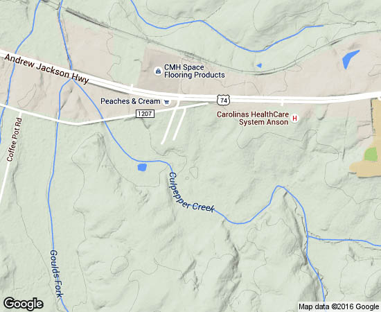
a small branch named
Culpepper Creek per the topo map. Culpepper Creek
has a
couple tributaries that connect and the main artery crosses Anson Senior
High School Road which flows into Gould's Fork, Brown Creek eventually terminating
into The Pee Dee River above the 109N Pee Dee River bridge. This section of our yard requires weed
trimming or a humongous amount of weed killer like Roundup which kills
everything for a season and very unsightly in my humble opinion. It
usually takes three hours and/or three tanks of fuel in the weed trimmer to
complete the job which I stretch it out to two or three mornings, normally
limiting myself to using one tank of fuel and then it is time to head for
the shower and take a serious break.
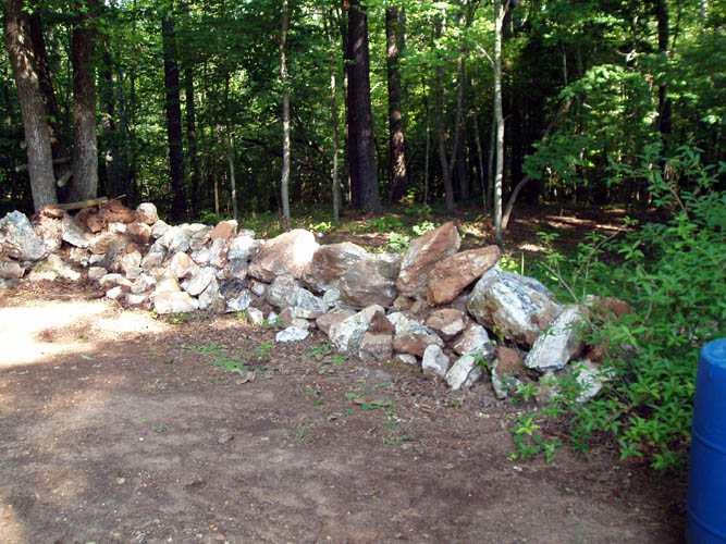
My bride constructed the retaining wall that are made of milky quartz stones
and she hauled them in a wheel barrow about 150 feet where our
rock pile is
locate by herself. She was a physically tough
woman
back then for sure!
According to Paul Walters, the prior owner of this property, he had many
truck loads of debris from the Wadesboro High School after it burned to fill
in a good portion of the back yard to have more useable area. Paul
also used the above steep drop off as his own personal land fill of which I
removed many truck loads of asphalt shingles, metal gutters, old swing set and
garbage that he had burned such as canned goods, etc. that should have been
hauled to the landfill. Up until around the year 2000, this property
was not annexed into the city limits and there was no garbage pick-up then
unless you contracted for it yourself. The above area
was grown up with some large pine trees, smaller hardwood trees and undergrowth
which resembled a jungle. Over twenty-seven (27) years, we have
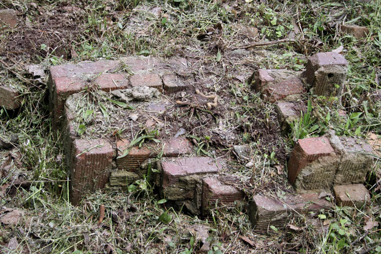
cleared and cleaned the mess up. The slope fill has settled and the bricks
and concrete from the Wadesboro High School debris is visible when I weed
trim it back several times each year.
Paul Walters also planted a silver maple tree right at the end of the
septic system drain field above the milky quartz rock retaining wall to the
far right which I
cut down, whereas the roots were clogging the nutrient rich drain field lines up.
That tree got extremely large due to it's food source.....grin if you must!
Close up pix of some of the ole Wadesboro High School bricks.
Web published update by Bill aka Mickey Porter on 04-27-16.
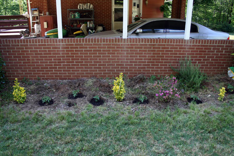
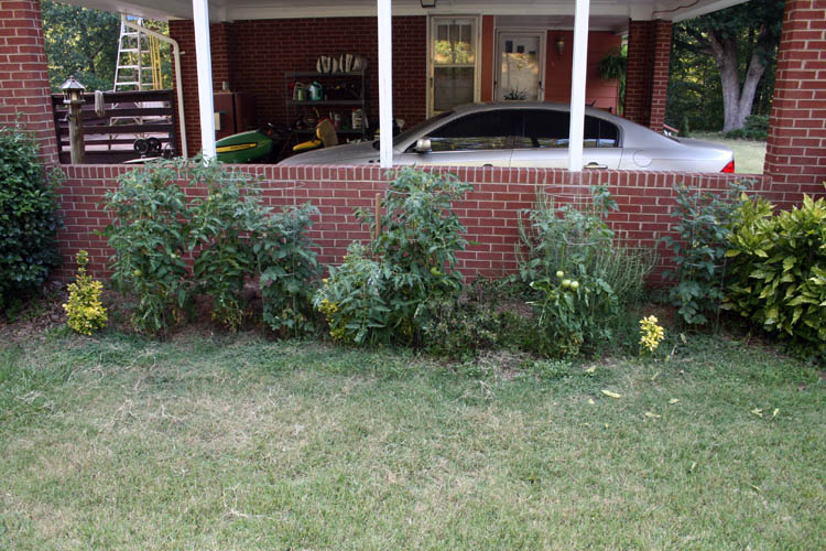
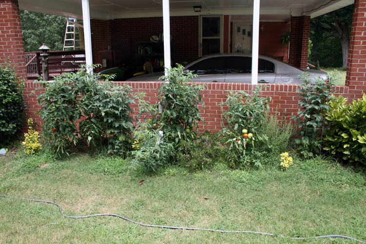
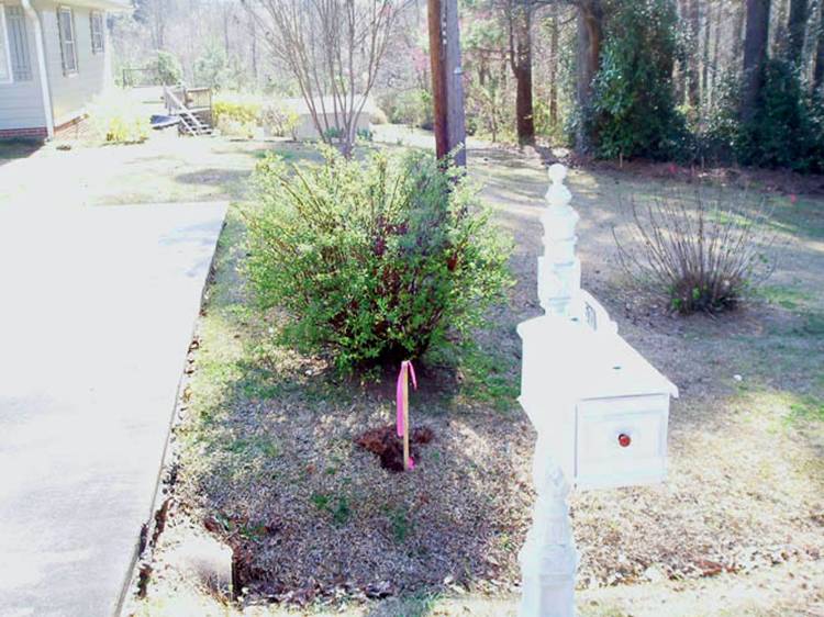
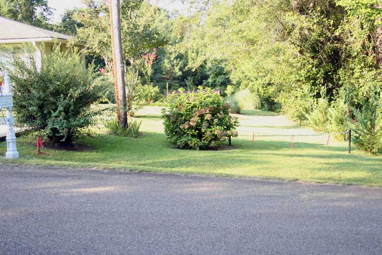
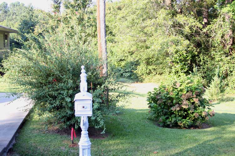
FLOWER BED TOMATOES
Every year or two, I usually have tomato plants in 5 gallon buckets or
larger containers on the deck but the past couple years have not had much
success with them. I decided this year to plant them beside or carport
where I had removed several holly bushes which had gotten out of hand on
their growth and they are a literal pain with the needle point leaves.
We planted them too close to the carport wall not knowing much about
planting trees and shrubbery.
We have enough area to plant a small garden but I had my fill of having
to weed a garden with a hoe when I was young and have not had a desire to
plant a small vegetable garden; bucket tomatoes is about as far as I will go
with planting food items.
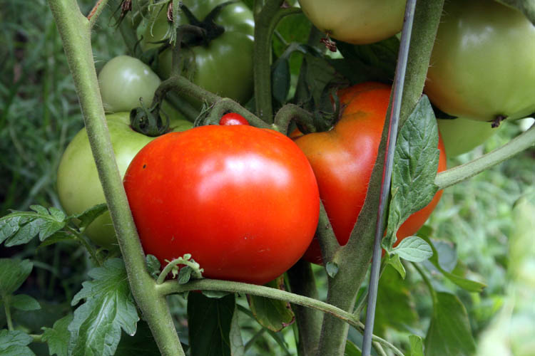
One of my bride and my self's favorite garden items is a home grown vine
ripe tomato preferably a BLT sandwich of which the bacon has to be
fried crisp, fresh Merita white bread slathered with Duke's brand
mayonnaise, fresh lettuce with salt and freshly ground black peppercorns and
a good slice or two or more of a beautimous ripe tomato....it doesn't get
any better than that in my humble opinion.
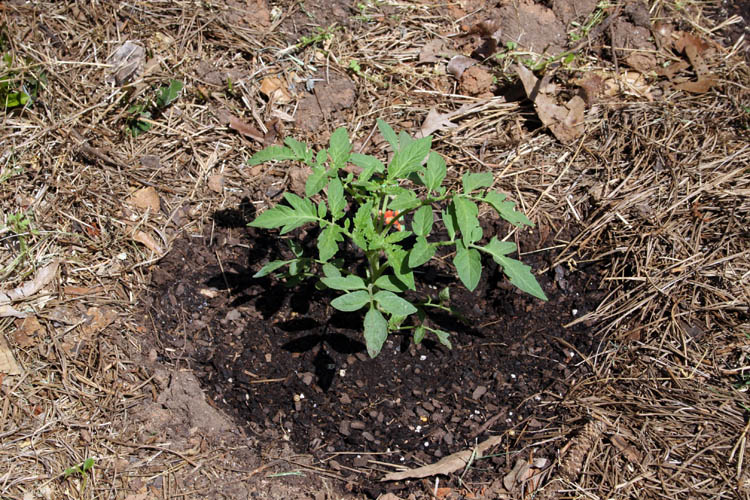
I planted four Red Beef Steak tomato plants and a couple Cherry tomato
plants and hopefully they will produce some excellent tomatoes; enough to
fill our craving for BLT sandwiches. I
forgot to add Epson salt to the hole dug to help prevent blossom end rot but
will mix a liquid solution up in a few days and sprinkle the plant down with
it before blossoms start to appear or just sprinkle about one tablespoon of
granular Epson salt around the base of each tomato plant and water them.
I plan to do a make over on the above area in the fall of the year,
hopefully after harvesting some beautimous vine ripe tomatoes.
Web published update by Bill aka Mickey Porter on 04-28-16.
The tomato plants are growing and it want be very long before we start
seeing some reds on them before too much longer....I can taste the BLT
sandwich right now!
Web published update by Bill aka Mickey Porter on 06-24-16.
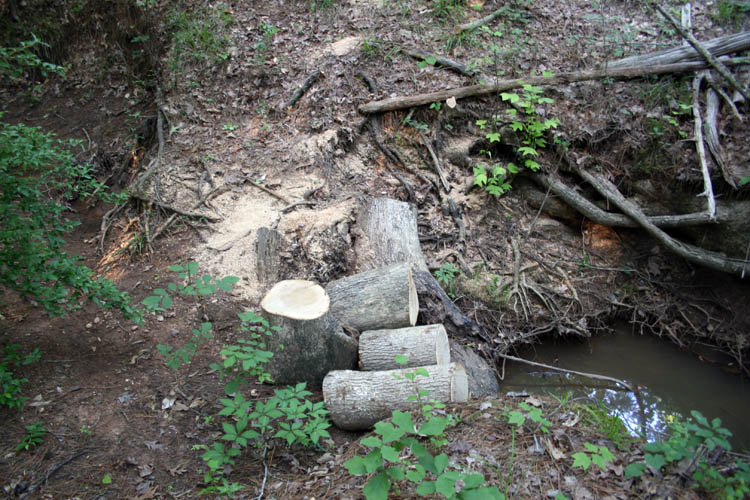
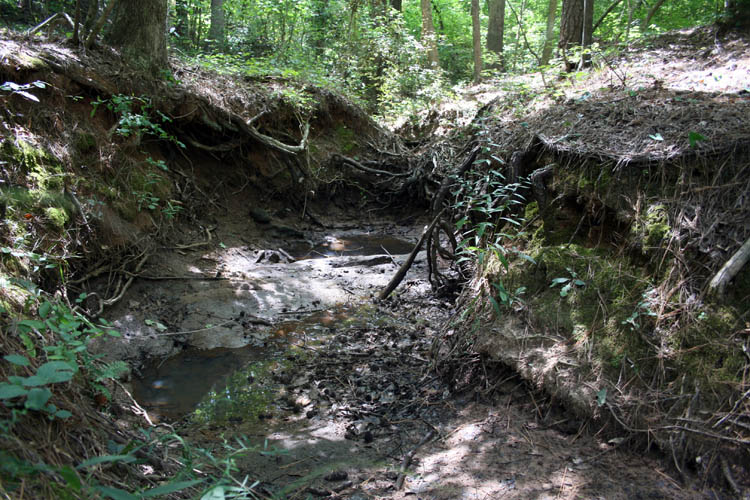
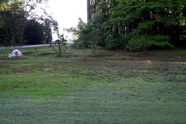
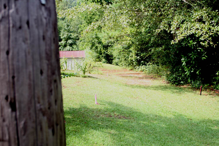
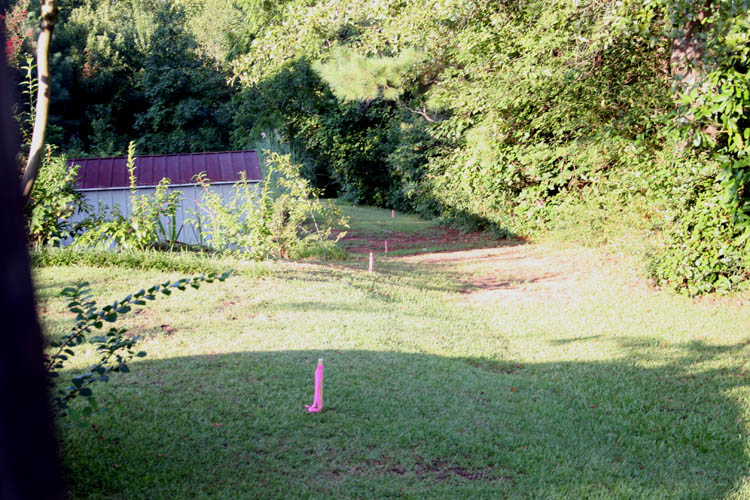
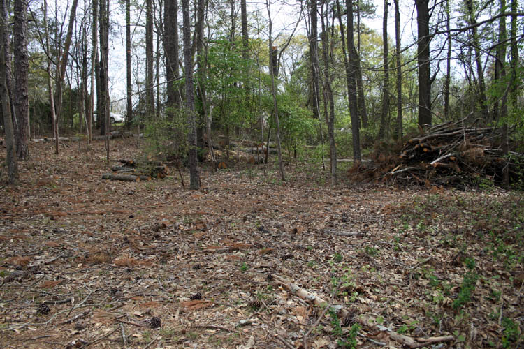
ANOTHER TREE CUT DOWN
Last year, a good sized Red Oak tree had fallen across the little creek (Culpepper
Creek) that meanders through part of our property out back and I
finally got tired of looking at the leaning tree which was visible from our back yard and
fired the ole Husqvarna chain saw up again. The tree as depicted from
the pixs was right on the edge of the little creek and had been leaning for
a few years, whereas the constant erosion from the flowing water finally got
the best of the root structure with gravity taking over. I didn't take
a pix of the before the chain saw work but below a few pixs after some
serious perspiration and energy used by yours truly.
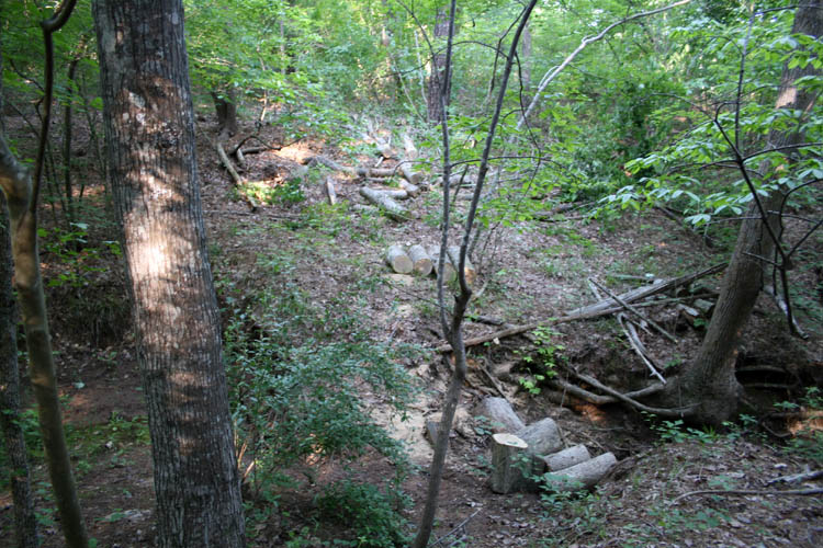
The flow of the little creek was impeded and now flows underneath the
learning tree until we have a heavy down pour of rain which causes the creek
to swell and would go over the top of the learning tree. I plan to go
back and start digging around the base of the tree and get the water flow
back on its normal course which will take some serious digging. In due
time, there is another tree within six feet of the fallen Red Oak tree which
will meet the same fate as it's root structure is being slowly eroded away
too.
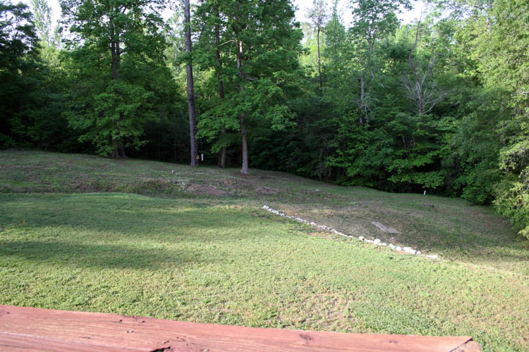
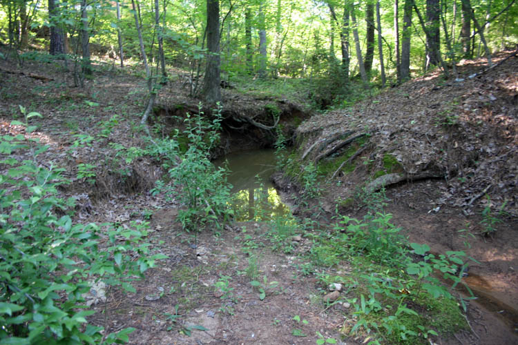
Pix below of the view looking South. At the peak of the summer
drought, this section of Culpepper Creek will be bone dry but sometimes the
water hole in the pix will have a little water in it. This
Southwestern leg of
the creek starts off White Store Road and flows into another leg of Culpepper Creek which crosses Anson High
School Road and then flows into Gould's Fork which crosses underneath
highway 74E beyond Peaches n Cream of which Gould's Fork will feed into
Brown Creek which terminates into the Pee Dee River above Highway 109 river
bride connecting to Montgomery County.
Back in the early 1980s, I trapped
two otters on this creek about 100 yards North from where these pixs were
taken and many raccoons when the fur market was very high. I
received 50 bucks each for the otter and the large size raccoons fetched 25
bucks each. I accessed the creek from Moore's Street where my bride's
Father and Mother
lived at that time.
Web published update by Bill aka Mickey Porter on 05-15-16 and 06-24-16.
The above water hole about dried up on 08-24-16 and a week later
was bone dry. There is a large rock shelf diagonally across the water
hole protruding about a foot and started to pan for gold but didn't get
around to it.
Anson County in the early to middle 1800s was a hot spot
for gold production, mostly placer gold and later went to the hard rock
mining when the placer gold deposits were no longer productive. The California gold rush
started after gold was found at
Sutter's Mill in 1848, whereas prospectors headed west seeking fortune
and fame being referred to as
49ers.
UPDATE ON TOMATO PLANTS 07-09-16
The cherry tomato plants are beginning to yield a few along and the
larger tomato plants are about ready to harvest a few of them for some good
ole BLT sandwiches.
Web published update by Bill aka Mickey Porter on 07-09-16.
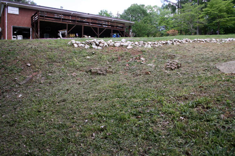
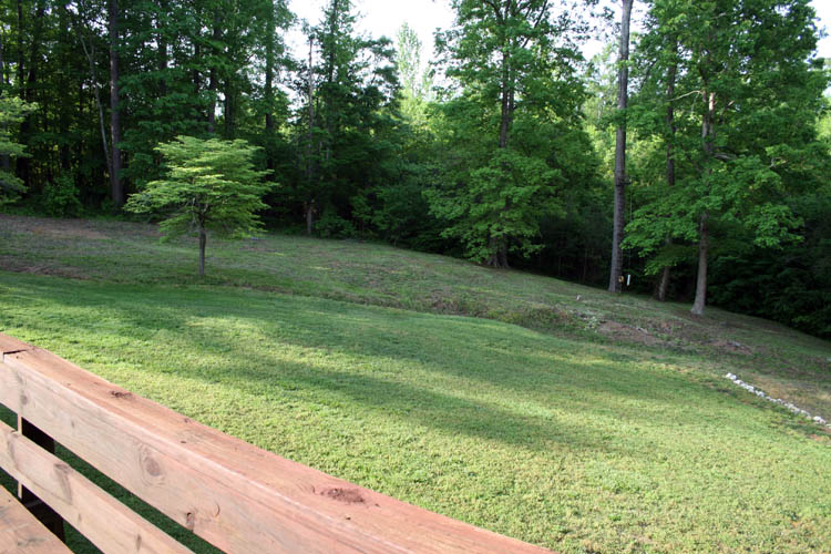
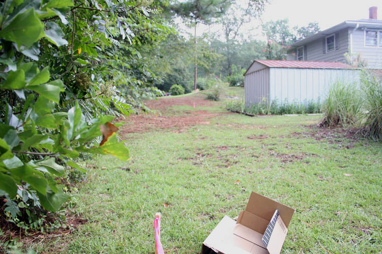
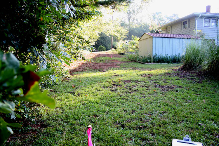
A COUPLE MORE TREES CUT DOWN
Below is a pix of the front and upper side yard from
June 2015 before the power company
contracted to have the power line right of way cleared. The upper side yard
area is mostly red clay and would barely grow weeds when we purchased the
property but with fertilizer and aeration, the yard is finally coming around
but it has been an uphill battle and slowly getting there. Since my
retirement on March 1, 2012, I have had more time to devote to getting the
yard in better shape.
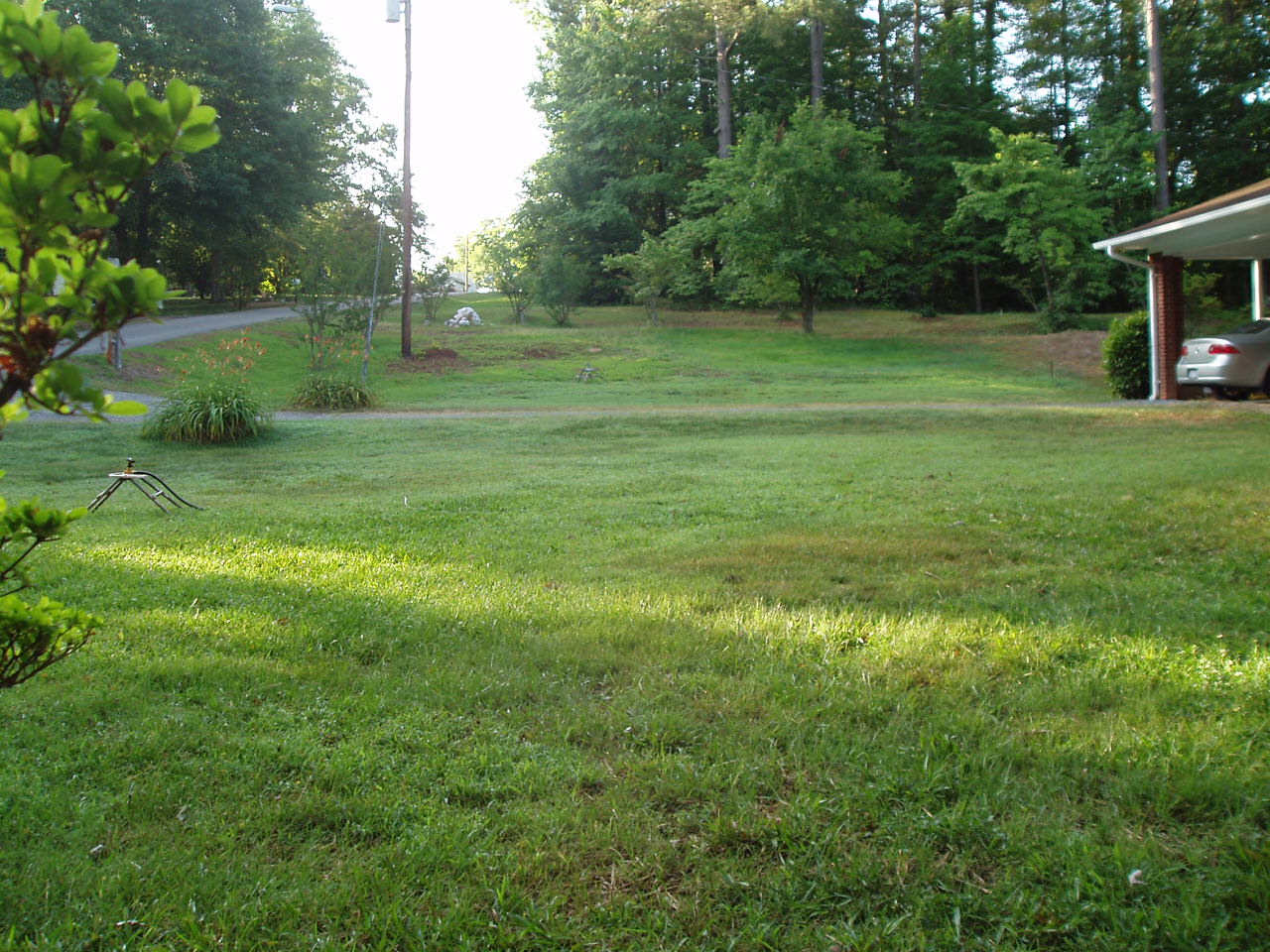
The Crabapple tree is in the upper center and a type of Holly tree to the
far right of the milky quartz rock were beginning to die out since last year
and had pruned the Holly tree back each year with a limb or two dieing out
and it was time to remove them. There is just enough room between the Holly
tree and a Crape Myrtle tree with the thorns on the Holly tree limbs
snagging you if too close to them.....ouch!
I cut the Holly tree down with a hand pruning saw and fired up the
Husqvarna chainsaw to cut the Crabapple tree down. Regular gloves including
leather ones do not work well at all and the thorns from both trees will
pierce the gloves and your hands without much effort at all. The trick is
to stay away from the thorns.
Below is pix of the area on 09-04-16 after the tree removal in the early
morning hours with dew on the ground:
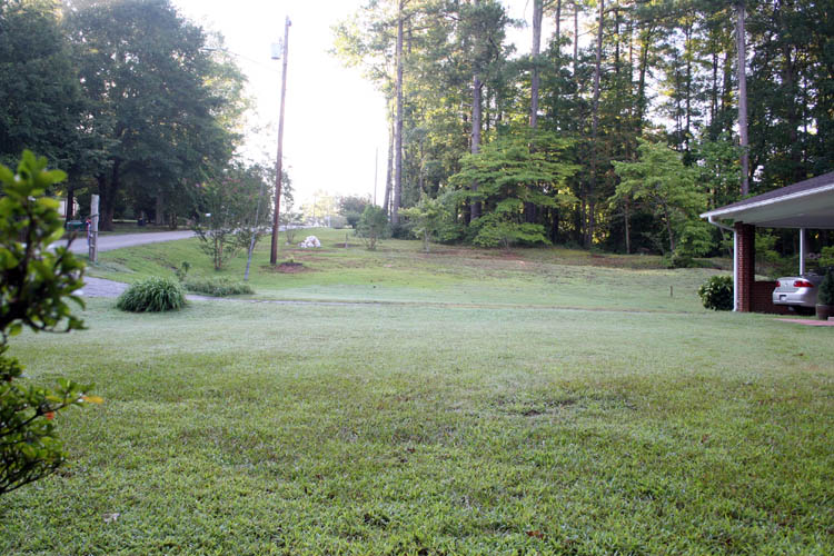
Maybe with the Crabapple tree gone, I can get a little more grass to grow
in that area. The depth of field of the yard increased with the Crabapple
tree removed and hopefully I raked up all the broken twigs with thorns from
the tree since I have lost a lawn tractor tire or two to those menacing
thorns which will pierce a hole into a tractor tire with much ease as
well.
Above, a close-up view of the upper yard with the two trees removed. I
plan to purchase another Troy Bilt tiller in the future to work up the yard
in places with sparse growing and/or no grass, mix in some additional
topsoil, fertilizer and sew Bermuda grass seeds in the upcoming Spring 2017,
the Lord willing of course. The sloping upper yard hillside
is prone to erosion by improper landscaping without a good grass root
structure. The tall red Fescue 31 grass planted last year didn't do very
well in the high temperature we had back in late summer of 2015 died out in
places and haven't grown back. There are a mixture of several different
types of grasses in the yard and you can see the much greener centipede grass
above.
Web published update by Bill aka Mickey Porter on
09-04-16.
POSTS AND CHAIN INSTALLATION
This is a continuation of a yard project that was documented on my
Yard Projects 2015 page. If anyone is interested, click on the
hyperlink. In a nutshell, we purchased two adjacent parcels to our
property on September 29, 2014 and desired the upper land get some trees
growing back where the people next to the property homesteaded it and
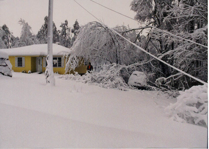
removed trees to increase their yard frontage facade. Below is a pix
taken after the
Blizzard 2000 of what the property looked like. The property
purchased, extends from the left side of the utility pole to our original
property line which is 133 feet of road frontage which is classified as
undeveloped land with some good pine and hardwood trees on it. The parcel
purchased was lot 13, 14 and 33 feet of lot 15 . Our home is part of lot
15 and part of track 2 below us. We had a
combination plat survey done of the upper lots and remainder of lower
track 2 Block C purchased and combined track 2 and lots 13, 14 and 15 with
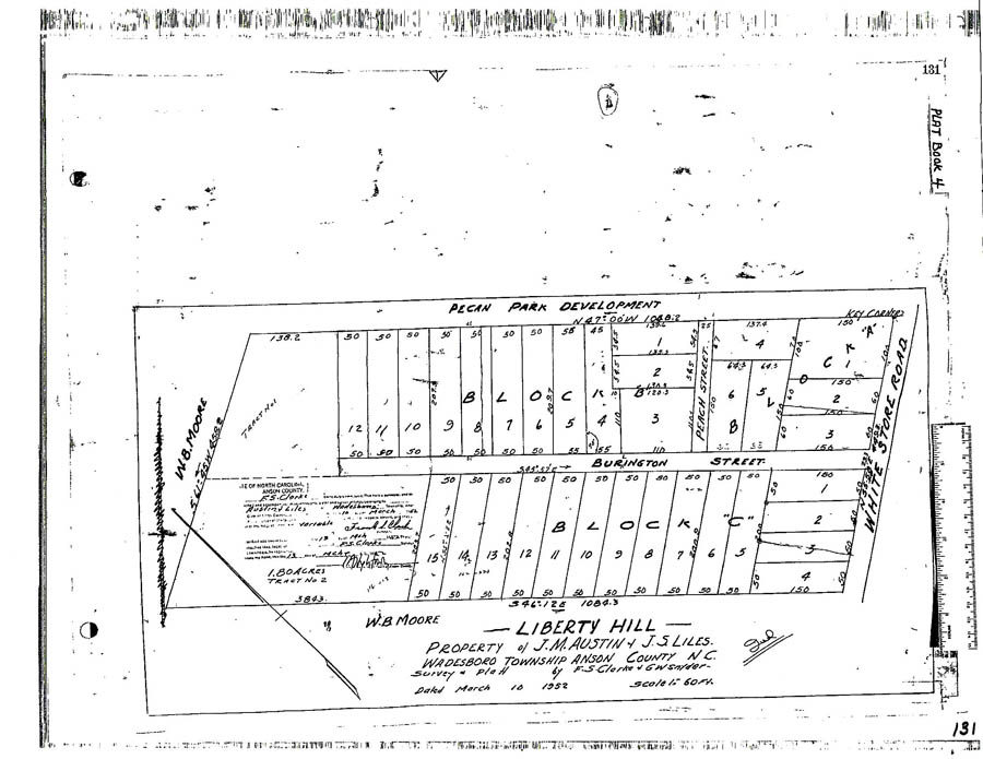
our home into one plat for tax purposes giving us 2.39 acres of land shown
on Original Liberty Hill Plat located in
Plat Book 4 Page 131 dated March 10, 1952. While not a large
Ponderosa, we have been very happy here since 1989 enjoying a somewhat
quiet and serene atmosphere surrounded by woods, plus we are the last
house on the dead end street. The road was never dragged past the end of
Burlington Street below our driveway and a
red diamond shaped warning sign marks the end of the paved
road. I installed a padlocked chain in the early 1990s to limit access to
our lower driveway and keep troublesome and annoying four wheelers and
dirt bikes off our property for the sake of
quietness and most
importantly, personal liability reasons.
With the purchase of the remaining track 2 Block C land bordering the ole
W. B. Moore Estate land which is now Alan Baucom Land Investments, a large
farming co-op, the Hodges 14 acre estate and ole Gloria Cameron 5.4 acre
Estate which is now owned by Donny Lee and Melissa Terry Dial, we own 1/2
interest in the road that wasn't dragged any farther probably due to it
going down into a deep drop off aka gulley.
Below pix of the corner property taken after the
Blizzard 2000:
Below is a satellite view screen captured off the Anson County GIS map
taken in 2005:
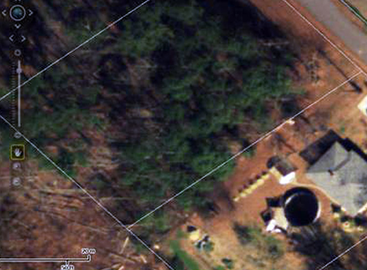
To get a proper perspective of the boundary grid lines, you have to
visualize them as if looking straight down from above and not at an
angle. As evidenced by the aerial image, there has been a good amount of
small trees and undergrowth removed from the corner to increase the
adjacent home owners front yard frontage facade. The boundary line to the
NE corner of the utility building is only 7' 2" measured with a tape.
Below is what the SE corner property line looked like on March 23, 2015
after we had it surveyed. The property line is slightly to the left of
the utility pole more or less straight away to the SW corner which is a
little over 200 feet. The lot is in the shape of a
parallelogram of which the majority
of the lots on this side of the street maintain the basic parallelogram
shape being a rectangle instead of square because of the width of each
individual lot being only 50 feet wide x 200 feet plus or minus in
length. It would take four (4) lots to make a true shaped parallelogram.
All the lots on the West side of Burlington Street are in the
parallelogram shape. Lots 1 thru 4 Block C in the Liberty Hill Plat are
adjacent White Store Road which curves to the right at the junction of
Burlington Street creating the starting leg of the parallelogram for lots
1 thru 15 and track 2 in Block C.
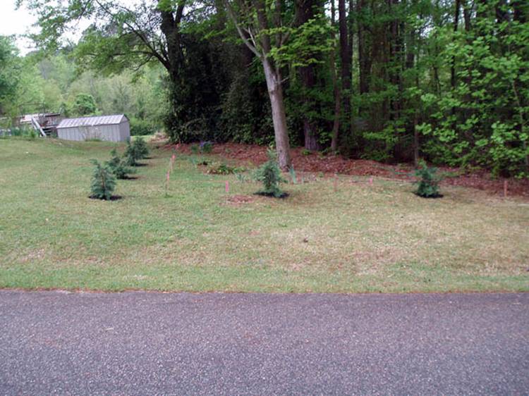
I planted six Leland Cypress trees after removing the full size wood
manger barn aka nativity scene to help fill in some of the prior
homesteaded lot. The prior owners had a couple metal yard chairs adjacent
the wood structure apparently to give the illusion the property belonged
to them because they never spent any time in them......grin if you must!
No sooner than I removed the wooden nativity aka manger barn, the adjacent
owner took it upon himself to park his truck on the property without
ascertaining who owned it or who had removed the wooden structure! After
the survey was completed, I advised the new owners not to park on that
area or drive vehicles across the corner. Within a week, the owner parked
two of his vehicles adjacent the large pine tree behind the row of Leland
Cypress trees planted which definitely was not his property. I should
have confronted him immediately but let it slide and this is where we are
at today!
To recap from last year, I explained to the new adjacent property
owners who purchased their home after
we purchased the adjacent lots what our goal for this property was on
March 23, 2015 and it apparently fell on deaf ears. The area between the
trees planted, the shrubbery and utility pole has just enough room for a
vehicle to go between and is used as an informal driveway whenever he
wants to take the easy access route to the rear of their property of which
the total width of their property consist of two 50 feet lots being 100
feet in width x 200 feet in length plus or minus. It is no small wonder
the prior owners for about fifteen (15) years
homesteaded both the lots on
each side of their property for a larger front yard facade. In contrast,
they planted trees on the adjacent lots 9 and 10 toward White Store Road
as a barrier to shield the view of their above ground pool, etc., whereas
Frances Pritchard and heirs of said lots live in Greensboro, NC not aware
of the land usage per Frances Pritchard and continue to pay the property
tax on the said land.
Instead of having a chain link property line fence installed at this
time, I decided to put a couple steel posts in the ground and attach a
padlocked chain across the nine feet section being used as a drive
through.
Another view of the front SE corner with the property line stake
flagged for reference. I placed the black iron pipe flagged stake
adjacent to the original corner stake which is a large bent bolt driven
below the ground surface marking the SE corner of the property we
purchased on September 29, 2014.
When it cools down some, I plan to pull a line from the front SE corner
stake to the rear SW property line stake of which the property line is to
the left of the utility pole and drive a few in ground black iron markers
in case we later decide to have a chain link property line fence
installed.
Sometime around 6 PM, the adjacent property owner pulled into our
driveway with his truck and a short trailer with nothing loaded on it and
he asked what was going on. I told him I installed the chain across the
area to keep vehicles off it and keep
him from using it as a driveway as well. I also explained
to him again, that I did
not want any vehicle traffic on that corner and had recently seen someone
that was cutting his grass access the property parking his truck and
trailer behind the area where the chain and posts were just installed.
The same individual was seen a few days later driving his truck across the
area to remove some firewood at the rear of his property and was using the
area just chained off for a driveway. I explained to that gentleman in a
peaceful and courteous manner not to use that property as a driveway
anymore since it did not belong to the adjacent home owner of which he
complied. There was another unrecognized vehicle that accessed the rear
of his property recently using our property as a driveway and I guess that
was "the straw that broke the camel's
back." The adjacent property owner said,
"He respected our property"
but it doesn't appear so to me because I had explained to him last year on
March 23, 2015 what my explicit intentions for this property was. I did
not offer to let him access the area either, otherwise I would be wasting
my time and manual labor installing the posts and chain.
I advised him he would have to go to plan B to access the rear of his
property of which there is barely enough room at the end of his lower
paved driveway adjacent our property which would require more effort on
his part to do so, but it is doable.
However, it would take some landscaping to make it as easily accessible as
his informal driveway through our property. There is enough room between
his property and the adjacent property to access the rear of his property
but it has a steep grade needing landscaping as well.
The following morning, I noticed that the adjacent property owner had
parked his truck and trailer now loaded with his lawn tractor on the other
side of his property on lot 9 and 10 belonging to Frances Pritchard and
heirs of Greensboro, NC, of which he doesn't have permission to use that
property either according to Mrs. Pritchard. Such much for
"respecting other people's property."
NO EASEMENT RIGHTS EVER GRANTED
It should be noted that no
easement rights have ever been granted by the original property owners
Bruner C. Lipe; deceased (year of death: 1976) and wife, Ellen H. Lipe,
deceased (year of death: 2001) or by the heirs of said lot 13 Bock C
Plat Book 4 Page 131 and deeds related to the sale of said property
dating back to October 30, 1951. We
have not issued any easement rights either verbal or
written since purchasing said property on September 29, 2014.
The Town of Wadesboro has "road
right of way" easement with marked boundaries on either
side of Burlington Street by concrete markers, but that does not grant any
right to use lot 13 as a personal parking space or driveway.
In all probability, I will have to get a chain link property line fence
installed to solve the problem since what I just did was a
"band aid fix" but wanted to
save several thousand dollars or more at this time. I have heard the ole
saying, "Good fences make good
neighbors" and it certainly appears to be true indeed!
Web published update by Bill aka Mickey Porter on 08-26-16.
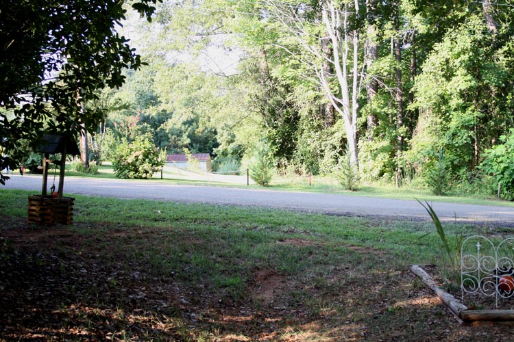
SE TO SW BOUNDARY LINE STAKES
INSTALLED BY JAMES RICHARD HARRINGTON SURVEYING
On 08-27-16, I observed James Richard Harrington Surveying truck turn
around in our driveway in the afternoon and figured that the adjacent
property owner wasn't satisfied or happy with our amicable discussion
yesterday evening and/or desired to know exactly where the property
boundary line runs which should not have been a problem since I personally
showed and explained to him the boundary corner stakes on March 23, 2015.
Richard Harrington's son who is employed by the business is friends with
the adjacent property owner and I guess he got a
Pro bono survey assessment in my humble opinion.
On 08-28-16 around 0915 hours while driving up the road to get my car
gas tank topped off, I noticed a line of four (4) wood surveying stakes
with fluorescent orange surveying ribbons tied to them, of which they
marked the SE to SW corner boundary of the property line. That will save
myself from pulling a line from the SE to SW stake and flagging the
boundary line. I plan to take a picture of the line of stakes/flags and
place a piece of black iron pipe into the ground slightly below the
surface on our side of the surveying stakes/flags for future reference for
a chain link property line fence.
As depicted by the line of boundary survey stakes, the adjacent
property owners do not have much side yardage to the right at all.
Apparently, Carol Anderson Reality and the other home owners did not show
the couple where the property
metes and bounds were located since there was no evidence of a survey
done prior to their purchase of the property, although there are two blue
colored iron pipe stakes at the rear of their property marking the SW and
NW corners that border the ole W. B. Moore estate land and the SW corner
of the lot 13 we purchased.
In the above and below pix, the survey stakes mark the SE/SW boundary
line of the property leaving limited area to access the rear of their
property from the paved road but there is enough yardage which will
require landscaping to reduce the incline. The distance between the
corner of the storage building and the third boundary stake/flag is 7'
2". The distance between the second boundary stake/flag to a large pine
tree to the right is 12' 3" as viewed from utility pole pix above. There
is a PVC gutter drain line that exits at ground level 5 feet from the
second stake toward the power pole and empties water onto our property
which has caused some erosion in the low area with sparse and/or no grass.
Another pix below taken in the morning versus mid-day.
To reiterate, in all probability it will be necessary to have a chain
link property line fence installed to solve the problem.
It is sad to have to resort to this type of action, but sometimes it is
necessary when people do not listen. The bottom line; I do not want
a driveway on that property for myself or no one else!
Web published updates by Bill aka Mickey Porter on
08-28-16 and 08-29-16.LEAVING ON A
SPIRITUAL NOTE
If you do not know Jesus Christ as your Lord and Savior, please take
this moment to accept him by Faith into your Life, whereby Salvation
will be attained.
Ephesians 2:8 - 2:9 8 For by grace are ye saved through
faith; and that not of yourselves: [it is] the gift of God: 9 Not of
works, lest any man should boast.
Hebrews 11:1 “Now faith is the substance of things hoped for,
the evidence of things not seen.”
Romans 10:17 “So then faith cometh by hearing, and hearing by
the word of God.”
Open this
link about faith in the King James
Bible.
Romans 10:9 “That if thou shalt confess with thy mouth the
Lord Jesus, and shalt believe in thine heart that God hath raised him
from the dead, thou shalt be saved.”
Open this
link of Bible Verses About Salvation,
King James Version Bible (KJV).
Hebrews 4:12 “For the word of God is quick, and powerful, and
sharper than any two edged sword, piercing even to the dividing asunder
of soul and spirit, and of the joints and marrow, and is a discerner of
the thoughts and intents of the heart.”
Romans 6:23 “For the wages of sin is death; but the gift of
God is eternal life through Jesus Christ our Lord.”
Romans 3:23 “For all have sinned, and come short of the glory
of God;”
Micah 6:8 “He hath shewed thee, O man, what is good; and what
doth the LORD require of thee, but to do justly, and to love mercy, and
to walk humbly with thy God?”
Philippians 4:13 "I can do all things through Christ which
strengtheneth me."


